True trailhead security isn’t about making your car unbreakable; it’s about making it an unprofitable target and ensuring you can always drive home.
- Deter thieves by altering their risk-reward calculation: make your car look completely empty and uninteresting.
- Prepare for inevitable failures (dead battery, lost key, no cell service) by building system redundancy into your plan.
Recommendation: Shift your mindset from just ‘preventing a break-in’ to a comprehensive ‘contingency plan’ that guarantees your self-rescue.
The sinking feeling of returning to the trailhead after a long hike, only to find shattered glass glittering on the ground, is a scenario every hiker dreads. It’s not just about the loss of valuables; it’s the violation and, more critically, the risk of being stranded miles from civilization with a disabled vehicle. Common advice like “hide your valuables” or “use an alarm” is tragically insufficient for the realities of a desolate parking area where thieves operate with impunity. These criminals are not opportunists; they are professionals who have a system.
The key is to disrupt their system. As a security consultant, I advise clients to move beyond simple prevention tactics and adopt a mindset of comprehensive threat modeling. This isn’t just about break-ins. It’s about rodents chewing through your wiring. It’s about a dead battery in a place with no cell service and no passing cars. It’s about your GPS leading you down a decommissioned logging road until you’re stuck.
This guide is built on a single, powerful principle: system redundancy. It’s about making your car an unappealing, unprofitable, and ultimately reliable target. We will dissect the thief’s risk-reward calculus, harden your vehicle against multiple threats, and build a robust contingency plan that ensures you are never the person left stranded at the end of the trail.
This article breaks down the essential strategies into a multi-layered security system. From pre-trip planning to on-site tactics, you’ll learn how to manage every potential point of failure.
Table of Contents: A Multi-Layered Approach to Trailhead Security
- Rat Nests: How to Stop Rodents from Chewing Wires While You Hike?
- Clean Car Theory: Why an Empty Seat Is the Best Deterrent?
- Jump Starter Packs: Why You Can’t Rely on Jumper Cables at Empty Trailheads?
- Hide-a-Key vs Carry: Where Is the Safest Place for Your Spare?
- Offline GPS: Why Google Maps Fails on Logging Roads?
- Airport to Trailhead: How Much Buffer Time Do You Need for Rental Counters?
- Approach and Departure: Will the Bumper Scrape on This Ditch?
- How to Plan a Remote Wilderness Expedition Without Getting Stranded?
Rat Nests: How to Stop Rodents from Chewing Wires While You Hike?
One of the most insidious threats to a vehicle left in the wilderness is not a two-legged thief, but a four-legged rodent. Modern cars often use soy-based wire insulation, which is an attractive food source for mice, rats, and squirrels. A few days is more than enough time for them to build a nest in your engine bay and chew through critical wiring, leaving you with thousands of dollars in damage and a car that won’t start.
Deterrence requires a multi-pronged approach. Start by making entry difficult. Use metal mesh screening to block obvious entry points like air intakes. Before you even park, scout the area. Avoid spots near dense brush or tall grass; opt for gravel or paved surfaces where rodents are less likely to travel. Some hikers have success with peppermint oil or other strong scents, but their effectiveness diminishes over time and in open air.
Case Study: The Limits of Capsaicin Tape
Honda’s rodent-deterrent tape, treated with spicy capsaicin, is a well-known solution. However, its real-world effectiveness is mixed. While it can discourage chewing on the specific wires it covers, it is not a complete solution as rodents can simply move to an unwrapped section. It works best as one layer in a broader strategy that includes physical barriers and careful site selection, reinforcing the idea that no single product is a magic bullet.
The most effective strategy is layering these deterrents. Apply capsaicin-treated tape to the most accessible and critical wiring harnesses. Block physical entry points with mesh. And finally, choose your parking spot with a rodent’s perspective in mind. By making your vehicle both unappetizing and difficult to access, you significantly lower the risk of this specific type of disabling damage.
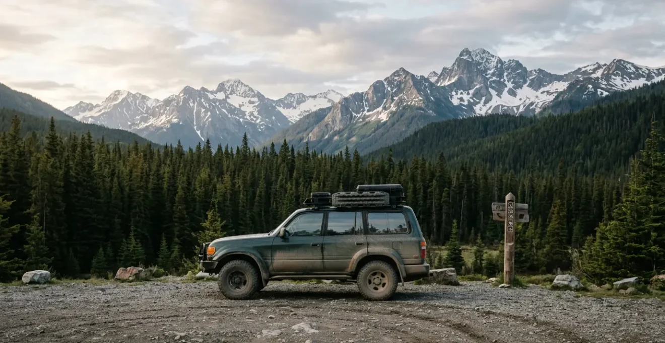
Clean Car Theory: Why an Empty Seat Is the Best Deterrent?
Trailhead crime, or “car clouting,” has seen a dramatic rise, with some jurisdictions reporting a nearly 100% increase in incidents over a single year. Thieves who target these remote lots are not casual opportunists; they are professionals working on a risk-reward basis. They want to get in, grab valuables, and get out in under 30 seconds. Your primary goal is to signal to them that the reward of breaking into your car is zero.
This is the essence of the “Clean Car Theory.” It goes beyond simply hiding valuables. You must make your car look so sterile, so empty, that the thief doesn’t even bother to take a closer look. This means nothing on the seats, floor, or dash. No charging cables, no jackets, no loose change, not even a piece of trash. A completely barren interior is the strongest visual deterrent.
The most advanced application of this theory is to leave your glove box and center console visibly open and empty. This is a powerful, non-verbal signal to a thief that you have already searched the car for them. It tells them, “I’ve done the work for you. There is nothing here. Move on to the next, more promising target.” It short-circuits their process and makes your vehicle an unprofitable waste of their time.
This strategy also means preparing *before* you arrive. Never move gear from your passenger cabin to your trunk in the trailhead parking lot. Thieves often watch from a distance, and seeing you “hide” a backpack is an open invitation. All gear should be secured and out of sight long before you reach your final destination. For rental cars, remove the branded keychains and any rental company stickers that scream “tourist with luggage.” The goal is to be the most boring, uninteresting car in the lot.
Jump Starter Packs: Why You Can’t Rely on Jumper Cables at Empty Trailheads?
A dead battery is one of the most common ways a wilderness trip ends in a call for a tow truck. At a remote trailhead, a set of jumper cables is utterly useless. They require a second vehicle, the one thing you are guaranteed not to have when you need it most. The only reliable solution is a self-contained, portable jump starter pack. This is not optional equipment; it is a critical piece of your vehicle’s survival kit.
However, not all jump starters are created equal, and the choice between the two main technologies—Lithium-Ion and Lead-Acid—has significant implications for a hiker. While traditional lead-acid packs are heavy and bulky, they have one advantage: they perform more reliably in extreme cold. Modern lithium-ion packs are vastly superior in almost every other way: they are lightweight, compact, hold a charge for months, and can provide multiple jump starts before needing a recharge.
The critical factor for backcountry use is cold-weather performance. Standard lithium batteries lose efficiency as temperatures drop. In fact, field performance data shows a significant reduction in cranking power below freezing, especially at -20°C (-4°F). If you frequent cold environments, you must invest in a specialty lithium model designed with a pre-heating or low-temperature function, or stick with a tried-and-true (though heavy) lead-acid unit.
| Feature | Lithium-Ion | Lead-Acid |
|---|---|---|
| Weight | Lightweight (1-3 lbs) | Heavy (20-35 lbs) |
| Cold Weather Performance | Reduced below 0°C, specialty models maintain efficiency to -20°C | More stable in extreme cold |
| Self-Discharge Rate | Very low (holds charge for months) | Higher (needs monthly recharging) |
| Jump Starts Per Charge | Multiple (15-20 for small engines) | Typically 1-2, requires recharge after each use |
| Lifespan | 5+ years with proper care | 2-3 years average |
| Multi-Function | USB ports, flashlight, air compressor | Limited additional features |
Owning a jump starter transforms a potentially trip-ending disaster into a minor inconvenience. It is a core component of system redundancy, removing your reliance on external help and ensuring you have the power to start your journey home.
Hide-a-Key vs Carry: Where Is the Safest Place for Your Spare?
Losing your car key on a multi-day hike is a nightmare scenario. The old solution was a magnetic hide-a-key box stuck to the car’s undercarriage. In the modern era, this is a terrible idea. Thieves are well aware of this tactic and routinely check wheel wells, bumpers, and frames as part of their standard procedure. A hide-a-key box is no longer a hiding place; it’s a gift-wrapped invitation to steal your car.
A modern security strategy requires more sophistication. The safest place for your primary key is on your person, secured in a zippered pocket inside your pack. But what about the spare? The best approach is a two-key redundancy system. This involves separating the electronic key fob from the physical, non-electronic valet key. Carry the expensive fob with you, and hide the simple metal key.
The hiding spot for this valet key must be off-vehicle. Use a small, waterproof container (like a geocache tube) and secure it 50-100 feet away from your car, near a memorable but discreet natural landmark—a uniquely shaped rock or a specific tree fork. This creates a significant barrier for a thief. Even if they break into your car, they can’t start it. Even if they search the immediate vicinity, they are unlikely to find it.
For vehicles with keyless entry and push-button start, there’s an additional threat: relay attacks. Thieves can use a device to amplify the signal from your key fob—even from a distance—to trick your car into unlocking and starting. The solution is to carry your key fob inside a Faraday pouch. These metallic-lined bags block all electronic signals, making your key invisible to scanners. This simple, inexpensive item is a non-negotiable piece of equipment for modern vehicle security.
Offline GPS: Why Google Maps Fails on Logging Roads?
Getting to a remote trailhead is often the final, most challenging part of the journey. This “last mile” is frequently on a network of poorly marked Forest Service or logging roads where cell service is a distant memory. Relying on consumer mapping apps like Google Maps or Waze in this environment is a recipe for disaster. These platforms are designed for paved, public road networks and often fail catastrophically in the backcountry.
Case Study: Why Consumer Maps Lead You Astray
The reason consumer maps fail is due to data latency and a critical lack of information about road status. A road that appears on Google Maps may have been decommissioned years ago, washed out last spring, or gated and closed to public traffic. The most reliable information comes from official sources. The U.S. Forest Service, for instance, publishes Motor Vehicle Use Maps (MVUMs). As one analysis points out, platforms built to display these official maps provide the most legally accurate information, which is why cross-referencing multiple, specialized sources is the only safe strategy for backcountry navigation.
A robust navigation strategy requires a dedicated offline GPS application on your smartphone. These apps allow you to download detailed maps—including topographic layers, satellite imagery, and crucial land ownership data—for use when you have no signal. The phone’s internal GPS chip works globally without cell service, so the app can pinpoint your location on the downloaded maps. Three of the leading platforms for this are Gaia GPS, onX Offroad, and Avenza Maps, each with unique strengths.
| Feature | Gaia GPS | onX Offroad | Avenza Maps |
|---|---|---|---|
| Primary Strength | Topographic layers, route tracking, multiple map overlays | Road status, land ownership data, trail legality | Official USFS Motor Vehicle Use Maps (MVUMs), professional cartography |
| Offline Capability | Requires Premium subscription ($39.99/year) | Available with subscription | Built for offline use, full GPS tracking without cell service |
| Best For | Backcountry explorers needing detailed topo and satellite imagery | Off-roaders needing road legality and ownership info | Professionals and those needing authoritative government maps |
| Map Sources | OpenStreetMap, USGS, satellite imagery, custom layers | Road networks, property boundaries, trail databases | National Geographic, government agencies, official publishers |
| Data Accuracy | Crowd-sourced (variable but often excellent detail) | Curated road and ownership data | Professionally created, constantly updated by publishers |
Never trust a single source. The safest approach is to cross-reference your route on multiple platforms before you lose service. A dedicated offline GPS plan is not just about convenience; it’s a critical safety system to prevent you from getting lost or stuck before your hike even begins.
Airport to Trailhead: How Much Buffer Time Do You Need for Rental Counters?
For fly-in expeditions, the rental car counter is the first potential point of failure. Underestimating the time needed here can have a cascading effect, forcing you to rush on unfamiliar roads or, worse, arrive at the trailhead after dark. As a rule of thumb, you should budget a minimum of 90 minutes buffer time from your scheduled landing to driving away, and even more during peak seasons or at busy hub airports.
This buffer accounts for several common risks. First, long lines are frequent, and “skipping the counter” with a loyalty program isn’t always an option at smaller, regional airports. Second, the vehicle class you booked might not be available, forcing you to negotiate or accept a substitute. This is a critical risk: being downgraded to a low-clearance sedan when you need an SUV for forest roads can derail your entire trip.
Your buffer time should also include a meticulous 20-minute vehicle inspection in the rental lot. Do not leave until you have checked for a spare tire and jack, tested the headlights, documented all pre-existing scratches and dings with your phone’s camera, and familiarized yourself with the car’s basic controls. This is also the time to pair your phone and pre-load the trailhead coordinates into your offline GPS app while you still have a data connection. Treating the rental car pickup as a tactical step, rather than a quick errand, mitigates significant downstream risk.
Approach and Departure: Will the Bumper Scrape on This Ditch?
The final few hundred feet to a trailhead parking spot can be the most damaging to your vehicle. Forest Service roads are notorious for deep ruts, high crowns, and large “water bars”—mounds of earth designed for drainage that can easily rip the bumper off a standard passenger car. Understanding your vehicle’s limitations and using proper technique is essential to avoid undercarriage damage.
Before your trip, you should know your vehicle’s approach, departure, and breakover angles. The approach angle governs how steep an obstacle you can drive up to without hitting your front bumper. The departure angle is the same for the rear. The breakover angle determines the largest hump you can drive over without getting high-centered. These specs are in your owner’s manual and are a crucial part of knowing if your vehicle is suitable for the intended roads.
When you encounter a ditch or water bar, the worst thing you can do is hit it head-on. This maximizes the chance of scraping a bumper or getting stuck. The professional technique is to use a diagonal approach. By positioning the vehicle at a 30-45 degree angle to the obstacle, you allow only one wheel to enter the depression at a time. This keeps the other three wheels on higher ground, maximizing your clearance and effectively “walking” the car across the obstacle. Drive slowly and deliberately.
Finally, a critical security tip for parking: never back into the spot. Always park facing out. This might seem counterintuitive, but it serves two purposes. First, it provides thieves with less cover to work on your trunk or rear hatch, as they are more exposed to the road. Second, and more importantly, it allows for a much quicker and safer exit if you need to leave in a hurry or if another vehicle is blocking you in. Visibility and exit strategy are key components of situational awareness.
Key Takeaways
- Your primary goal is to make your vehicle an unprofitable, uninteresting, and reliable target.
- Adopt a “system redundancy” mindset for everything: power, keys, navigation, and security.
- A comprehensive contingency plan for worst-case scenarios is the ultimate form of security.
How to Plan a Remote Wilderness Expedition Without Getting Stranded?
The culmination of all this planning is a robust, proactive contingency plan—what I call a “Plan for Failure” protocol. A successful remote trip isn’t one where nothing goes wrong; it’s one where you have already anticipated and planned for potential failures. Some high-risk trailheads can see 1-2 break-ins per week during peak season, according to park rangers. You must assume you could be a target and have a response ready.
This protocol revolves around a simple pre-trip document left with a trusted contact. It should include your exact trailhead coordinates, a detailed vehicle description (make, model, color, license plate), your planned itinerary and timeline, and a set of “if-then” instructions (e.g., “If no satellite message by 8 PM Sunday, call County Sheriff at X, then Ranger District at Y”). This document transforms your emergency contact from a worried bystander into an effective part of your rescue team.
The final, non-negotiable piece of equipment is a satellite messenger (like a Garmin inReach or Zoleo). This device is your lifeline. It is not just for on-trail emergencies; it is a critical part of your vehicle security system. If your car is stolen or disabled and your phone is gone, the satellite messenger is your only link to the outside world to contact law enforcement, roadside assistance, or your emergency contact with your exact GPS coordinates.
Your ‘Plan for Failure’ Pre-Trip Audit
- Scenario 1 – Car Won’t Start: Do you have a fully charged, cold-weather-appropriate jump starter? Is your spare key accessible? Can you contact help via satellite messenger with your exact coordinates?
- Scenario 2 – Car Damaged (Break-in/Flat): Do you have a way to temporarily secure a broken window (tape/plastic)? Is your spare tire inflated and do you have the tools to change it? Can you contact law enforcement and your insurance company via satellite?
- Scenario 3 – Car Gone (Stolen): Can you immediately provide the County Sheriff with your vehicle’s VIN, license plate, and description? Have you activated your emergency contact protocol? Do you have a pre-researched backup extraction plan (e.g., local shuttle service number saved offline)?
- Pre-Trip Documentation: Have you left a detailed plan with a trusted contact, including coordinates, timeline, and specific if-then instructions for initiating a response?
- The Lifeline Check: Is your satellite messenger fully charged, subscription active, and positioned as your primary link for both trail safety and vehicle security emergencies?
By systematically identifying single points of failure and building in redundancy, you transform a potentially chaotic and dangerous situation into a manageable problem with a clear set of solutions. This is the essence of professional security planning.
Ultimately, trailhead security is an exercise in risk management. By implementing these layered strategies, you are not just protecting your property; you are investing in your safety and ensuring that every adventure ends with a safe drive home. Start implementing this mindset on your very next trip.